Hiking in Burnaby Mountain Park

Burnaby Mountain Park is a popular hiking destination, with its network of trails. Located east of the city, the peak of this dominant geographical feature stands 366 metres (1214 ft) above sea level, offering impressive views of downtown Vancouver, the North Shore, Burrard Inlet and the surrounding areas. The park encompasses the Burnaby Mountain Conservation Area and Simon Fraser University, and is surrounded by lush west coast forest.
The park has a large number of different trails that are suitable for hikers of all levels of experience and fitness, including beginner trails that follow wide gravel paths with minimal elevation gain. Intermediate trails feature more difficult terrain with steep climbs, exposed tree roots and rocky sections, and advanced trails include challenging obstacles such as log hops and stairs.
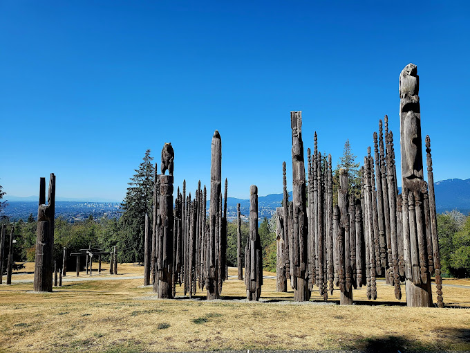
There are also several recreational facilities and buildings at the park, including a rose garden, a playground, washrooms, day use picnic sites, a bike park, and viewpoints. The park also features a number of sculptures, including totem pole-like carvings and sculptures by Nuburi Toko that commemorate the city's relationship with Kushiro (on the island of Hokkaido in northern Japan), the sister city of Burnaby.
The Pipeline Trail West runs from the main parking lot on North Road to the eastern boundary of the park, near Coquitlam. From here, a wide gravel path ascends towards the park's highest point. From the top of this trail, there are expansive views of downtown Vancouver, the North Shore, and Indian Arm. The trail passes by a few unique trail names such as Hang Your Hat, Gnomes Homes and Cardiac Hill before descending back to the parking lot along Powerline Trail.
Alternatively, hikers can take the Barnet Trail to the west, following its route along the park's lower section. After a short ascent, the trail descends with views of the Suncor Energy Refinery below. As you continue, the trail curves left, passing a junction with Cardiac Hill Trail and then right onto Mel's Trail, which eventually connects to Nicole's Trail.
This loop trail is a great way to see the best parts of Burnaby Mountain. From the top of Nicole's Trail, there are incredible views of the city and the surrounding mountains. The trail then descends and winds through a forest full of old-growth trees. At the end of the trail, hikers can rest at the top of the Velodrome Trail, which is a short, moderately steep trail with impressive views.
The park is open from dawn to dusk, year-round. The entrance is off Lougheed Highway, and there's limited street parking nearby. Public transit is also an option, with routes running from Lougheed Town Centre and Coquitlam Station. Download the Moovit app for live bus and train schedules. It is available for iOS and Android devices, and offers up-to-the-minute data on bus and subway service. Moovit also provides detailed walking directions to Burnaby Mountain Park, as well as other local attractions and points of interest in the area.
